Table of Contents
Suicide Cliff is located at Kowloon Peak (also known as Fei Ngo Shan), and is one of the most popular hikes in Hong Kong, right alongside the Lion Rock Hike and the Victoria Peak Hike. From the top, you can get some of the most spectacular views of the Kowloon peninsula and Hong Kong, especially during sunset.

For this reason, it remains as one of my favourite hikes and I often recommend it along with my other favourite hike, Mount High West, to anyone visiting Hong Kong.
In this guide, I will show you everything you need to know about hiking Suicide Cliff, including how to get to the starting point, the route, the view from Kowloon Peak, and some frequently asked questions. I’ll also share tips and precautions to make your hike safe and enjoyable.
1 Is Suicide Cliff Safe?

Suicide Cliff has garnered a bit of a bad rep because of its name. A question that’s often asked is whether or not the hike is safe? The answer is – it depends. The hike has two paths – climbing directly up to the cliff, or hiking via Kowloon Peak.
The path via Kowloon Peak is a gradual incline spread over a longer distance – making it very safe. The path up directly to Suicide Cliff is rugged and steep, and I don’t recommend taking this path unless you know what you’re doing.
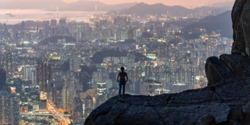
In saying that, regardless of the path you take you should always be sensible and not do anything stupid. The photo below shows a prime example of that. The drop from this rock is a sheer 300 meters – one slip is all it takes to end up being another statistic. Once again, If you don’t do anything stupid, this hike is perfectly safe.

2 Hiking Summary
| Difficulty Level | Medium to Difficult |
| Road Conditions | 30% paved, 70% unpaved |
| Elevation Gain | 409 metres | 1,340 ft |
| Peak Elevation | 584 metres | 1,915 ft |
| Total Distance | 3.5 km | 2.15 miles |
| Total Time | 2.5 hours |
The Suicide Cliff hike is about 3.5 km long and takes about 2 to 3 hours to complete. The trail is mostly dirt and rocks, with some sections that require scrambling and climbing. Certain sections of the trail are not well-marked, so be sure to follow the photo instructions in this guide to stay on track.
3 How to Get to the Starting Point?
The starting point of the Suicide Cliff hike is at Fei Ngo Shan Road, which is accessible by minibus. The easiest way to get there is by taking the MTR to Choi Hung Station, and then taking the green minibus 1A to Fei Ngo Shan Road. Start by taking Exit C from Choi Hung Station.
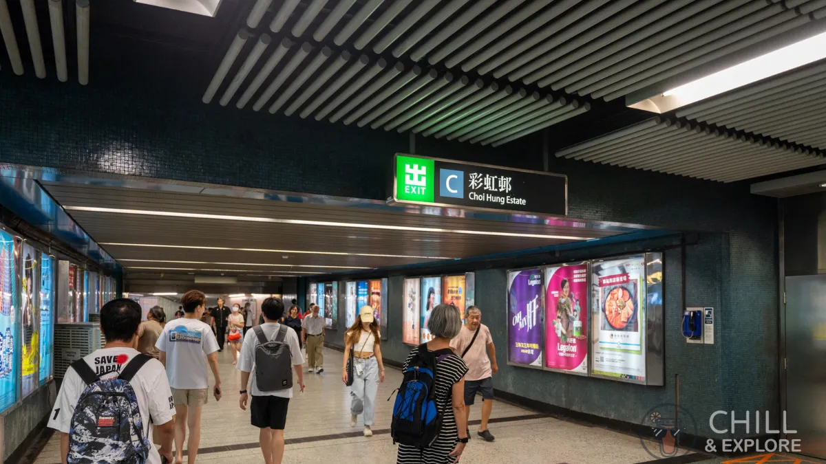
Follow the signs to Exit C2 towards Lung Cheung Road. Walk up the slope towards the street level.
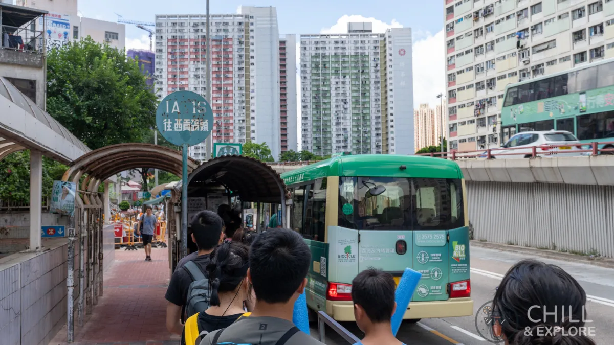
The key thing to remember is to tell the minibus driver you want to get off at Fei Ngo Shan Road. You can do this by shouting “Fei Ngo Shan Doh Yau Lok”, which means “I’m getting off at Fei Ngo Shan Road”, about 200 metres before the bus gets there. Note that there is no bus stop there so the driver will not stop even if you press the next stop button.

Once you get off at Fei Ngo Shan Road, you will see a road sign that says “Clear Water Bay Road” with a small set of stairs going uphill. Our journey to the trailhead begins here.

The path here is paved, so just follow it up but be mindful of vehicles coming up and down. Along the way, you should come across a rock with the words 飛鵝山 (Fei Ngo Shan) printed on it.
Continue making your way up and walk past the numerous luxury houses along Fei Ngo Shan Road.

After about 25 minutes of walking, you should come across a sign that says Ma On Shan Country Park. Keep following the arrow up.

The trailhead is just another 5-minute walk away. Other than the “Danger” sign, there’s nothing else that marks it as a trailhead to Kowloon Peak. So be on the lookout for the markings below.

4 Trailhead to Kowloon Peak
Our hike begins at the danger sign. Don’t worry – As I mentioned above, this hike is safe so long as you follow the necessary precautions.

Begin by walking up the stairs, and you’ll notice a grave just at the top of the stairs. Walk past that and continue heading up.

The steps are relatively easy to climb, with wooden beams added to make the steps very stable.
As you keep heading up, you’ll come across another large rock with the words 上落平安 written on the side. This translates to safe travels.

Let’s keep heading up. As you get close to the top, you’ll notice a lot more tall grass. If you take a look around, you’ll get a birds eye view of the Sai Kung peninsula.
This is a great point to slow things down and walk up casually. The view was so good that I just kept turning back!

You should have a clear view of the transmission station up on Kowloon Peak at this point. We will be heading there before making our way down to Suicide Cliff.
There are a couple of paths you can take once at the top. On your right is the path towards Elephant Hill and the Kowloon Peak Viewing Point. There is dense bushes along this path though I still saw a lot of people heading North along this path.
We’ll be turning left and heading south towards the Kowloon Peak transmission station. There’s a helipad located right next to the transmission tower. I was lucky enough to see this very cute dog photoshoot going on!
Needless to say, everyone got their cameras out to capture this moment! Look at all those good boys!

The doggos got some treats after their hard work.

After a quick walk around the helipad, it’s time to take the steps up to the transmission tower to get a 360-degree view of the city.

If you look towards the west, you can get a clear view of Lion Rock Mountain. The lion head is particularly noticeable from this angle!

Looking south, you get a clear view of the Hong Kong Island and Victoria Harbour!

Looking north, you can get a beautiful shot of Elephant Hill and the rest of Kowloon Peak.

The transmission tower is a great place for a quick selfie! This is also the starting point where we begin heading to suicide cliff!

Here’s a wider shot of the transmission tower along with the cityscape.

5 Kowloon Peak to Suicide Cliff
From the transmission station, follow the paved steps down, holding the handrail as necessary. The view of the mountain with the city as a backdrop makes for a stunning photo!
Here’s a wider shot of where we’re heading. Be careful, and walk down slowly.
Once you reach the fenced-off structure at the bottom, turn left and walk along the grass path.

Walk along the fence slightly uphill to make your way around it.

Continue walking down to the end of the trail.
From here, you can get plenty of stunning shots of the city and enjoy the sunset safely.

6 Scaling down Suicide Cliff
At this point, you are where the white arrow is pointing.
Continuing down further becomes considerably more dangerous. If you are not comfortable with heights or begin to have doubts about your ability, I would strongly recommend that you end your hike here.
The red arrow is the first platform you will encounter as your head down. It’s a bit of a red herring and it is not the spot where you see all the famous photos taken. Of course, you can take photos here but it won’t have the same effect as the lower platform since the vantage point is not ideal.

Here’s another shot from the side. The green arrow is where the real spot is. As you can see from the photo, this is double the distance from the first platform. The photosn taken from here are considerably better looking.
To get further down, you will need to scale down rocks and walk down steep paths. At some points, you will have to crawl down onto your butt on all four limbs and edge yourself down.

As you head further down, you will eventually make your way to the actual cliff.
7 View from Suicide Cliff during Sunset
The first thing that came to my head when I saw this view was “awe-inspiring”. I couldn’t believe how stunning the city looked as the sun began to set. I’ve done plenty of hikes but nothing quite compared to this view.


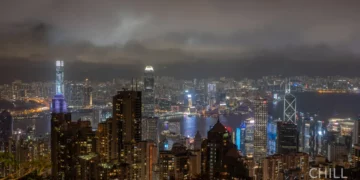
8 View from Suicide Cliff at Night


9 Ending our hike
After you’re done admiring the view and taking plenty of Instagrammable photos, it’s time to head back home. Similar to the way up, there are two paths we can take:
- Hiking down the steep slope to Fei Ngo Shan Road.
- Tracing our steps back up to Kowloon Peak and back to Fei Ngo Shan Road.
If you’re planning to finish your hike around sunset, I would strongly urge you to take the path back via Kowloon Peak.
I (perhaps foolishly) chose to scale down the mountain directly to Fei Ngo Shan Road at night – which definitely made things considerably more difficult. If you decide to do the same, you must bring a reliable headlamp! You cannot rely on the flashlight from your phone as it is not powerful enough, and you will also need both your hands to scale down. Trust me!

The route back down goes through dense trees that can have sharp spikes. The path is also not clearly marked, making our journey that much more confusing. I didn’t take photos of this section since operating a camera and scaling down was too dangerous.
I also ran into a couple of other people who had sustained injuries on their way back down, mentioning that they had tripped on branches and scrapped themselves against rocks or twigs and were bleeding. Keep this in mind if you plan on going down this path.
10 FAQs
How difficult is the Suicide Cliff hike?
The Suicide Cliff hike is rated as difficult, as it involves some steep and rocky sections that require scrambling and climbing. Sections of the trail are not well-marked, so you need to pay attention to the direction along the way. The trail is not suitable for beginners or people who are afraid of heights, as there are some drops and cliffs along the way.
How long does the Suicide Cliff hike take?
The Suicide Cliff hike takes about 2 to 3 hours to complete, depending on your pace and fitness level. The trail is about 3.5 km long, and the elevation gain is about 400 meters.
Is Suicide Cliff safe?
Suicide Cliff is safe if you follow the trail and exercise caution and common sense. You should not get too close to the edge or lean over the cliff, as there have been some accidents and fatalities at this spot. You should always hike with a partner or a group, and inform someone of your itinerary and expected return time. You should also carry a headlamp if returning at night.
Our Verdict
Suicide Cliff & Kowloon Peak Hike
Suicide Cliff is a challenging and rewarding hike that offers breathtaking views of Hong Kong. It is a steep and rocky trail that leads to the summit of Kowloon Peak, where you can enjoy panoramic views of the city and the sea. Suicide Cliff is not for the faint-hearted, as it involves some scrambling and exposure to heights. However, if you are well-prepared and confident, you will be rewarded with one of the most spectacular views in Hong Kong.
PROS
- Stunning sunset spot
- Unique city photo spot
CONS
- Dangerous (if hiking down to the cliff)

